Email
Maine Geological Survey Releases 2025 Coastal Beach Mapping Data
| From | Maine Department of Agriculture, Conservation and Forestry <[email protected]> |
| Subject | Maine Geological Survey Releases 2025 Coastal Beach Mapping Data |
| Date | October 29, 2025 7:02 PM |
Links have been removed from this email. Learn more in the FAQ.
Links have been removed from this email. Learn more in the FAQ.
View as a webpage / Share [ [link removed] ]
[ [link removed] ] [ [link removed] ]
Maine Geological Survey
*For Immediate Release*
October 29, 2025
*Maine Geological Survey Releases 2025 Coastal Beach Mapping Data*
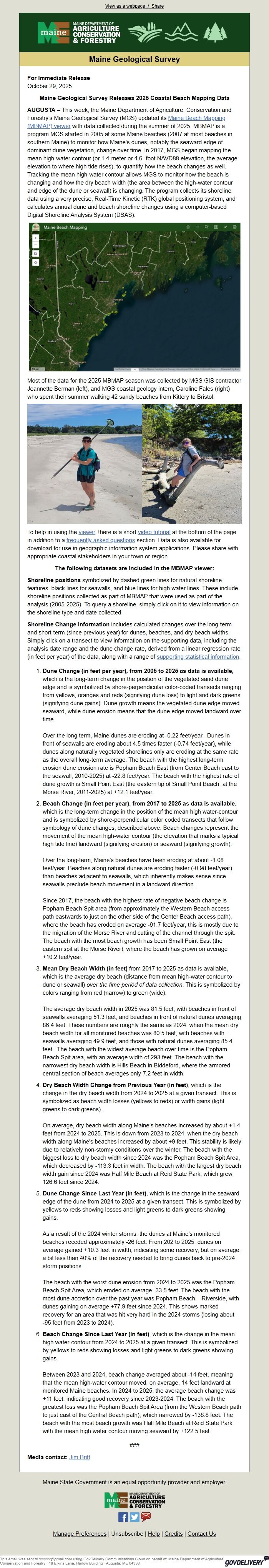
*AUGUSTA* – This week, the Maine Department of Agriculture, Conservation and Forestry's Maine Geological Survey (MGS) updated its Maine Beach Mapping (MBMAP) viewer [ [link removed] ] with data collected during the summer of 2025. MBMAP is a program MGS started in 2005 at some Maine beaches (2007 at most beaches in southern Maine) to monitor how Maine’s dunes, notably the seaward edge of dominant dune vegetation, change over time. In 2017, MGS began mapping the mean high-water contour (or 1.4-meter or 4.6- foot NAVD88 elevation, the average elevation to where high tide rises), to quantify how the beach changes as well. Tracking the mean high-water contour allows MGS to monitor how the beach is changing and how the dry beach width (the area between the high-water contour and edge of the dune or seawall) is changing. The program collects its shoreline data using a very precise, Real-Time Kinetic (RTK) global positioning system, and calculates annual dune and beach shoreline changes using a computer-based Digital Shoreline Analysis System (DSAS).
Maine Beach Mapping [ [link removed] ]
Most of the data for the 2025 MBMAP season was collected by MGS GIS contractor Jeannette Berman (left), and MGS coastal geology intern, Caroline Fales (right) who spent their summer walking 42 sandy beaches from Kittery to Bristol.
Beach Mappers [ [link removed] ]
To help in using the viewer [ [link removed] ], there is a short video tutorial [ [link removed] ] at the bottom of the page in addition to a frequently asked questions [ [link removed] ] section. Data is also available for download for use in geographic information system applications. Please share with appropriate coastal stakeholders in your town or region.
*The following datasets are included in the MBMAP viewer:*
*Shoreline positions* symbolized by dashed green lines for natural shoreline features, black lines for seawalls, and blue lines for high water lines. These include shoreline positions collected as part of MBMAP that were used as part of the analysis (2005-2025). To query a shoreline, simply click on it to view information on the shoreline type and date collected.
*Shoreline Change Information *includes calculated changes over the long-term and short-term (since previous year) for dunes, beaches, and dry beach widths. Simply click on a transect to view information on the supporting data, including the analysis date range and the dune change rate, derived from a linear regression rate (in feet per year) of the data, along with a range of supporting statistical information [ [link removed] ].
* *Dune Change (in feet per year), from 2005 to 2025 as data is available,* which is the long-term change in the position of the vegetated sand dune edge and is symbolized by shore-perpendicular color-coded transects ranging from yellows, oranges and reds (signifying dune loss) to light and dark greens (signifying dune gains). Dune growth means the vegetated dune edge moved seaward, while dune erosion means that the dune edge moved landward over time.
Over the long term, Maine dunes are eroding at -0.22 feet/year. Dunes in front of seawalls are eroding about 4.5 times faster (-0.74 feet/year), while dunes along naturally vegetated shorelines only are eroding at the same rate as the overall long-term average. The beach with the highest long-term erosion dune erosion rate is Popham Beach East (from Center Beach east to the seawall, 2010-2025) at -22.8 feet/year. The beach with the highest rate of dune growth is Small Point East (the eastern tip of Small Point Beach, at the Morse River, 2011-2025) at +12.1 feet/year.
* *Beach Change (in feet per year), from 2017 to 2025 as data is available,* which is the long-term change in the position of the mean high water-contour and is symbolized by shore-perpendicular color coded transects that follow symbology of dune changes, described above. Beach changes represent the movement of the mean high-water contour (the elevation that marks a typical high tide line) landward (signifying erosion) or seaward (signifying growth).
Over the long-term, Maine’s beaches have been eroding at about -1.08 feet/year. Beaches along natural dunes are eroding faster (-0.98 feet/year) than beaches adjacent to seawalls, which inherently makes sense since seawalls preclude beach movement in a landward direction.
Since 2017, the beach with the highest rate of negative beach change is Popham Beach Spit area (from approximately the Western Beach access path eastwards to just on the other side of the Center Beach access path), where the beach has eroded on average -91.7 feet/year, this is mostly due to the migration of the Morse River and cutting of the channel through the spit. The beach with the most beach growth has been Small Point East (the eastern spit at the Morse River), where the beach has grown on average +10.2 feet/year.
* *Mean Dry Beach Width (in feet)* from 2017 to 2025 as data is available, which is the average dry beach (distance from mean high-water contour to dune or seawall) "over the time period of data collection". This is symbolized by colors ranging from red (narrow) to green (wide).
The average dry beach width in 2025 was 81.5 feet, with beaches in front of seawalls averaging 51.3 feet, and beaches in front of natural dunes averaging 86.4 feet. These numbers are roughly the same as 2024, when the mean dry beach width for all monitored beaches was 80.5 feet, with beaches with seawalls averaging 49.9 feet, and those with natural dunes averaging 85.4 feet. The beach with the widest average beach over time is the Popham Beach Spit area, with an average width of 293 feet. The beach with the narrowest dry beach width is Hills Beach in Biddeford, where the armored central section of beach averages only 7.2 feet in width.
* *Dry Beach Width Change from Previous Year (in feet)*, which is the change in the dry beach width from 2024 to 2025 at a given transect. This is symbolized as beach width losses (yellows to reds) or width gains (light greens to dark greens).
On average, dry beach width along Maine’s beaches increased by about +1.4 feet from 2024 to 2025. This is down from 2023 to 2024, when the dry beach width along Maine’s beaches increased by about +9 feet. This stability is likely due to relatively non-stormy conditions over the winter. The beach with the biggest loss to dry beach width since 2024 was the Popham Beach Spit Area, which decreased by -113.3 feet in width. The beach with the largest dry beach width gain since 2024 was Half Mile Beach at Reid State Park, which grew 126.6 feet since 2024.
* *Dune Change Since Last Year (in feet)*, which is the change in the seaward edge of the dune from 2024 to 2025 at a given transect. This is symbolized by yellows to reds showing losses and light greens to dark greens showing gains.
As a result of the 2024 winter storms, the dunes at Maine’s monitored beaches receded approximately -26 feet. From 202 to 2025, dunes on average gained +10.3 feet in width, indicating some recovery, but on average, a bit less than 40% of the recovery needed to bring dunes back to pre-2024 storm positions.
The beach with the worst dune erosion from 2024 to 2025 was the Popham Beach Spit Area, which eroded on average -33.5 feet. The beach with the most dune accretion over the past year was Popham Beach – Riverside, with dunes gaining on average +77.9 feet since 2024. This shows marked recovery for an area that was hit very hard in the 2024 storms (losing about -95 feet from 2023 to 2024).
* *Beach Change Since Last Year (in feet)*, which is the change in the mean high water-contour from 2024 to 2025 at a given transect. This is symbolized by yellows to reds showing losses and light greens to dark greens showing gains.
Between 2023 and 2024, beach change averaged about -14 feet, meaning that the mean high-water contour moved, on average, 14 feet landward at monitored Maine beaches. In 2024 to 2025, the average beach change was +11 feet, indicating good recovery since 2023-2024. The beach with the greatest loss was the Popham Beach Spit Area (from the Western Beach path to just east of the Central Beach path), which narrowed by -138.8 feet. The beach with the most beach growth was Half Mile Beach at Reid State Park, with the mean high water contour moving seaward by +122.5 feet.
###
*Media contact:* Jim Britt <[email protected]>
Maine State Government is an equal opportunity provider and employer.
[ [link removed] ]
Facebook [ [link removed] ] Twitter [ [link removed] ] Email Updates [ [link removed] ]
Manage Preferences [ [link removed] ] | Unsubscribe [ [link removed] ] | Help [ [link removed] ] | Credits [ [link removed] ] | Contact Us [ [link removed] ]
________________________________________________________________________
This email was sent to [email protected] using GovDelivery Communications Cloud on behalf of: Maine Department of Agriculture, Conservation and Forestry · 18 Elkins Lane, Harlow Building · Augusta, ME 04333 GovDelivery logo [ [link removed] ]
[ [link removed] ] [ [link removed] ]
Maine Geological Survey
*For Immediate Release*
October 29, 2025
*Maine Geological Survey Releases 2025 Coastal Beach Mapping Data*
*AUGUSTA* – This week, the Maine Department of Agriculture, Conservation and Forestry's Maine Geological Survey (MGS) updated its Maine Beach Mapping (MBMAP) viewer [ [link removed] ] with data collected during the summer of 2025. MBMAP is a program MGS started in 2005 at some Maine beaches (2007 at most beaches in southern Maine) to monitor how Maine’s dunes, notably the seaward edge of dominant dune vegetation, change over time. In 2017, MGS began mapping the mean high-water contour (or 1.4-meter or 4.6- foot NAVD88 elevation, the average elevation to where high tide rises), to quantify how the beach changes as well. Tracking the mean high-water contour allows MGS to monitor how the beach is changing and how the dry beach width (the area between the high-water contour and edge of the dune or seawall) is changing. The program collects its shoreline data using a very precise, Real-Time Kinetic (RTK) global positioning system, and calculates annual dune and beach shoreline changes using a computer-based Digital Shoreline Analysis System (DSAS).
Maine Beach Mapping [ [link removed] ]
Most of the data for the 2025 MBMAP season was collected by MGS GIS contractor Jeannette Berman (left), and MGS coastal geology intern, Caroline Fales (right) who spent their summer walking 42 sandy beaches from Kittery to Bristol.
Beach Mappers [ [link removed] ]
To help in using the viewer [ [link removed] ], there is a short video tutorial [ [link removed] ] at the bottom of the page in addition to a frequently asked questions [ [link removed] ] section. Data is also available for download for use in geographic information system applications. Please share with appropriate coastal stakeholders in your town or region.
*The following datasets are included in the MBMAP viewer:*
*Shoreline positions* symbolized by dashed green lines for natural shoreline features, black lines for seawalls, and blue lines for high water lines. These include shoreline positions collected as part of MBMAP that were used as part of the analysis (2005-2025). To query a shoreline, simply click on it to view information on the shoreline type and date collected.
*Shoreline Change Information *includes calculated changes over the long-term and short-term (since previous year) for dunes, beaches, and dry beach widths. Simply click on a transect to view information on the supporting data, including the analysis date range and the dune change rate, derived from a linear regression rate (in feet per year) of the data, along with a range of supporting statistical information [ [link removed] ].
* *Dune Change (in feet per year), from 2005 to 2025 as data is available,* which is the long-term change in the position of the vegetated sand dune edge and is symbolized by shore-perpendicular color-coded transects ranging from yellows, oranges and reds (signifying dune loss) to light and dark greens (signifying dune gains). Dune growth means the vegetated dune edge moved seaward, while dune erosion means that the dune edge moved landward over time.
Over the long term, Maine dunes are eroding at -0.22 feet/year. Dunes in front of seawalls are eroding about 4.5 times faster (-0.74 feet/year), while dunes along naturally vegetated shorelines only are eroding at the same rate as the overall long-term average. The beach with the highest long-term erosion dune erosion rate is Popham Beach East (from Center Beach east to the seawall, 2010-2025) at -22.8 feet/year. The beach with the highest rate of dune growth is Small Point East (the eastern tip of Small Point Beach, at the Morse River, 2011-2025) at +12.1 feet/year.
* *Beach Change (in feet per year), from 2017 to 2025 as data is available,* which is the long-term change in the position of the mean high water-contour and is symbolized by shore-perpendicular color coded transects that follow symbology of dune changes, described above. Beach changes represent the movement of the mean high-water contour (the elevation that marks a typical high tide line) landward (signifying erosion) or seaward (signifying growth).
Over the long-term, Maine’s beaches have been eroding at about -1.08 feet/year. Beaches along natural dunes are eroding faster (-0.98 feet/year) than beaches adjacent to seawalls, which inherently makes sense since seawalls preclude beach movement in a landward direction.
Since 2017, the beach with the highest rate of negative beach change is Popham Beach Spit area (from approximately the Western Beach access path eastwards to just on the other side of the Center Beach access path), where the beach has eroded on average -91.7 feet/year, this is mostly due to the migration of the Morse River and cutting of the channel through the spit. The beach with the most beach growth has been Small Point East (the eastern spit at the Morse River), where the beach has grown on average +10.2 feet/year.
* *Mean Dry Beach Width (in feet)* from 2017 to 2025 as data is available, which is the average dry beach (distance from mean high-water contour to dune or seawall) "over the time period of data collection". This is symbolized by colors ranging from red (narrow) to green (wide).
The average dry beach width in 2025 was 81.5 feet, with beaches in front of seawalls averaging 51.3 feet, and beaches in front of natural dunes averaging 86.4 feet. These numbers are roughly the same as 2024, when the mean dry beach width for all monitored beaches was 80.5 feet, with beaches with seawalls averaging 49.9 feet, and those with natural dunes averaging 85.4 feet. The beach with the widest average beach over time is the Popham Beach Spit area, with an average width of 293 feet. The beach with the narrowest dry beach width is Hills Beach in Biddeford, where the armored central section of beach averages only 7.2 feet in width.
* *Dry Beach Width Change from Previous Year (in feet)*, which is the change in the dry beach width from 2024 to 2025 at a given transect. This is symbolized as beach width losses (yellows to reds) or width gains (light greens to dark greens).
On average, dry beach width along Maine’s beaches increased by about +1.4 feet from 2024 to 2025. This is down from 2023 to 2024, when the dry beach width along Maine’s beaches increased by about +9 feet. This stability is likely due to relatively non-stormy conditions over the winter. The beach with the biggest loss to dry beach width since 2024 was the Popham Beach Spit Area, which decreased by -113.3 feet in width. The beach with the largest dry beach width gain since 2024 was Half Mile Beach at Reid State Park, which grew 126.6 feet since 2024.
* *Dune Change Since Last Year (in feet)*, which is the change in the seaward edge of the dune from 2024 to 2025 at a given transect. This is symbolized by yellows to reds showing losses and light greens to dark greens showing gains.
As a result of the 2024 winter storms, the dunes at Maine’s monitored beaches receded approximately -26 feet. From 202 to 2025, dunes on average gained +10.3 feet in width, indicating some recovery, but on average, a bit less than 40% of the recovery needed to bring dunes back to pre-2024 storm positions.
The beach with the worst dune erosion from 2024 to 2025 was the Popham Beach Spit Area, which eroded on average -33.5 feet. The beach with the most dune accretion over the past year was Popham Beach – Riverside, with dunes gaining on average +77.9 feet since 2024. This shows marked recovery for an area that was hit very hard in the 2024 storms (losing about -95 feet from 2023 to 2024).
* *Beach Change Since Last Year (in feet)*, which is the change in the mean high water-contour from 2024 to 2025 at a given transect. This is symbolized by yellows to reds showing losses and light greens to dark greens showing gains.
Between 2023 and 2024, beach change averaged about -14 feet, meaning that the mean high-water contour moved, on average, 14 feet landward at monitored Maine beaches. In 2024 to 2025, the average beach change was +11 feet, indicating good recovery since 2023-2024. The beach with the greatest loss was the Popham Beach Spit Area (from the Western Beach path to just east of the Central Beach path), which narrowed by -138.8 feet. The beach with the most beach growth was Half Mile Beach at Reid State Park, with the mean high water contour moving seaward by +122.5 feet.
###
*Media contact:* Jim Britt <[email protected]>
Maine State Government is an equal opportunity provider and employer.
[ [link removed] ]
Facebook [ [link removed] ] Twitter [ [link removed] ] Email Updates [ [link removed] ]
Manage Preferences [ [link removed] ] | Unsubscribe [ [link removed] ] | Help [ [link removed] ] | Credits [ [link removed] ] | Contact Us [ [link removed] ]
________________________________________________________________________
This email was sent to [email protected] using GovDelivery Communications Cloud on behalf of: Maine Department of Agriculture, Conservation and Forestry · 18 Elkins Lane, Harlow Building · Augusta, ME 04333 GovDelivery logo [ [link removed] ]
Message Analysis
- Sender: Maine Department of Agriculture, Conservation and Forestry
- Political Party: n/a
- Country: United States
- State/Locality: Maine
- Office: n/a
-
Email Providers:
- govDelivery