
May 21, 2025
******FOR IMMEDIATE RELEASE******
Media Contact:
Wyoming State Geological Survey
WSGS Releases New Geologic Maps of Rawlins and Red Desert Basin Quadrangles
LARAMIE, Wyo. — The Wyoming State Geological Survey (WSGS) has published updated geological maps of the Rawlins and Red Desert Basin quadrangles, providing critical new insights into the geology, natural resources, and land-use potential across central southern Wyoming. The mapped area extends east from Rock Springs to just beyond Rawlins and spans from the Killpecker Sand Dunes in the north to Miller Hill and Delaney Rim in the south.
These new maps incorporate the latest field data and updates based on high-resolution lidar imagery. Geologists focused particularly on the complex geology of the Rawlins and Rock Springs uplifts, as well as the Great Divide Basin, northern Atlantic Rim, and parts of the Washakie Basin. The mapped region includes geologic formations ranging primarily from Cretaceous to Quaternary in age, with older Mesozoic, Paleozoic, and Precambrian rocks prominently exposed in the Rawlins Uplift.
"Accurate geological mapping is essential for resource development in Wyoming," said Erin Campbell, WSGS Director and State Geologist. "These updated quadrangles greatly improve our understanding of local geology, providing critical support for resource exploration."
Both quadrangles are published as Map Series, with accompanying Geologic Map Schema (GeMS) Level 3-compliant geodatabases.
The region covered by these quadrangles is economically significant, containing uranium, hydrocarbon resources, coal, and potential sites for CO₂ sequestration. The area is also a major transportation corridor, covering a large portion of U.S. Interstate 80, the railway corridor, and part of U.S. Highway 287. The new geological maps will enable more effective resource exploration, geologic hazard mitigation, and informed planning decisions, benefiting state and local governments, industry, and the public.
Both maps are available through the WSGS website and include comprehensive supporting documentation for further research and decision-making purposes. These maps can be directly downloaded here: Geologic map of the Red Desert Basin 30' x 60' quadrangle, Sweetwater County, Wyoming (2025), Geologic map of the Rawlins 30' x 60' quadrangle, Carbon and Sweetwater counties, Wyoming (2025).
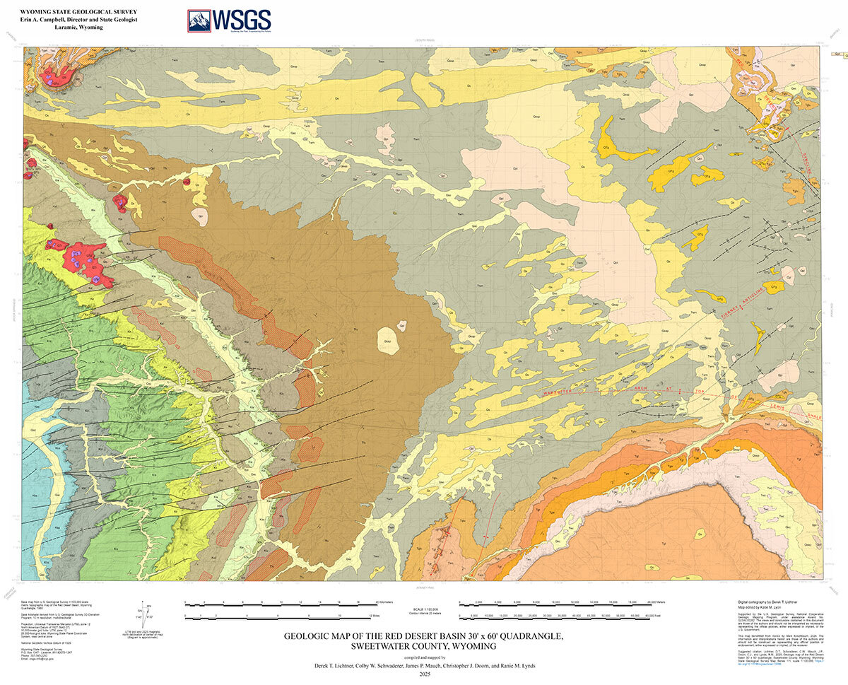
Portion of WSGS Map Series 111, Geologic map of the Red Desert Basin 30' x 60' quadrangle,
Sweetwater County, Wyoming
| |
Exploring the past, empowering the future Email: |
Stay Connected
SUBSCRIBER SERVICES:
Manage Subscriptions | Unsubscribe All | Subscriber Help
| This email was sent to [email protected] using GovDelivery Communications Cloud on behalf of: Wyoming State Geological Survey · P.O. Box 1347 · Laramie, WY 82073 · 307-766-2286 |